


Tete de chien (panorama) 553m 180m+

ericberlin
User
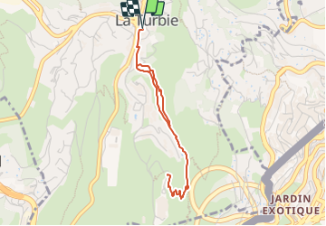

Length
4.1 km

Max alt
553 m

Uphill gradient
183 m
Km-Effort
6.5 km

Min alt
436 m

Downhill gradient
184 m
Boucle
Yes
Creation date :
2023-08-02 12:51:57.923
Updated on :
2023-08-02 12:53:43.675
1h28
Difficulty : Medium

FREE GPS app for hiking
 SityTrail
IGN / Geographical institutes
SityTrail Plus
The world is yours!
About
Trail Walking of 4.1 km to be discovered at Provence-Alpes-Côte d'Azur, Maritime Alps, La Turbie. This trail is proposed by ericberlin.
Positioning
Country:
France
Region :
Provence-Alpes-Côte d'Azur
Department/Province :
Maritime Alps
Municipality :
La Turbie
Location:
Unknown
Start:(Dec)
Start:(UTM)
371234 ; 4844773 (32T) N.
Comments